ORNL Study Taps Flickr for CBR Safety Study
Written by William C. Vantuono, Editor-in-Chief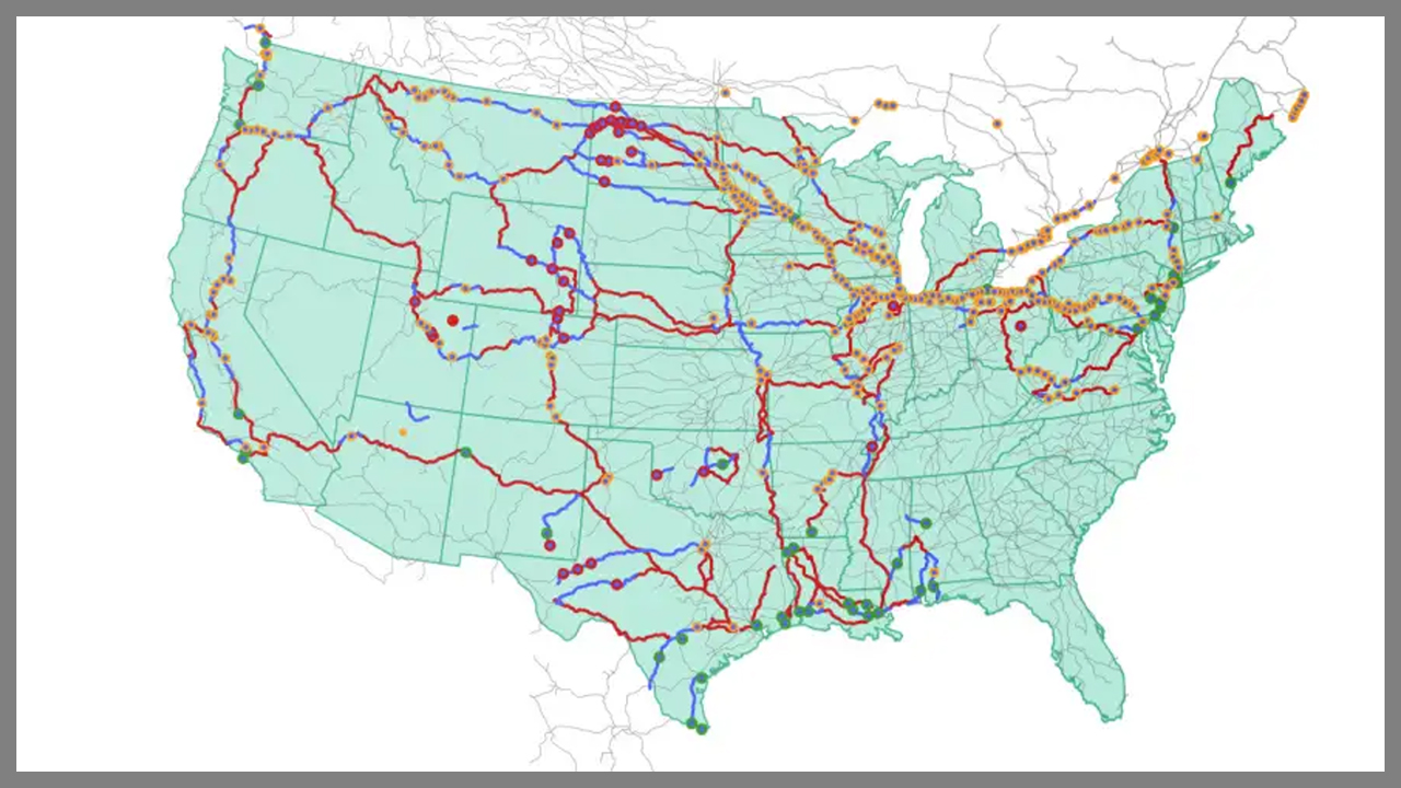
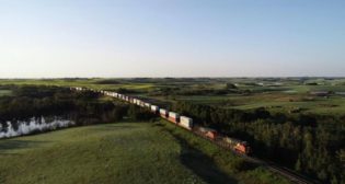
Oak Ridge National Laboratory image
Oak Ridge National Laboratory researchers have used images from the photo-sharing website Flickr to identify U.S. CBR (crude by rail) routes “to provide data that could help transportation planners better understand regional impacts.” The study was published in Transportation Research Record: Journal of the Transportation Research Board.
“More than 300 crude oil rail incidents have occurred in the U.S. over the past decade, causing adverse consequences from fire and hazardous materials leakage,” said Majbah Uddin of ORNL’s Transportation Analytics and Decision Sciences Group. “However, only limited information on the transport routes has been publicly available. Our inferred routes aligned with approximately 96% of the documented crude oil incidents, and some of these routes traversed metropolitan areas. With this visual data, there is now a good foundation for understanding potential risks along the rail routes.”
Researchers used geotagged online crude oil train images from Flickr to reconstruct transport paths. By linking these images with the national railway network, the team “was able pinpoint the areas through which trains likely passed.”
Abstract
“Safety issues associated with transporting crude oil by rail have been a concern since the boom of the U.S. domestic shale oil production in 2012. During the past decade, over 300 [CBR] incidents have occurred in the United States. Some of them have caused adverse consequences including fire and hazardous materials leakage. However, only limited information on [CBR] routes and their associated risks is available to the public. To this end, this study proposed an unconventional way to reconstruct [CBR] routes using geotagged photos harvested from the Flickr website. The proposed method linked the geotagged photos of crude oil trains posted online with national railway networks to identify potential railway segments that those crude oil trains were traveling on. A shortest path-based method was applied to infer the complete [CBR] routes, by utilizing the confirmed railway segments as well as their directional information. Validation of the inferred routes was performed using a public map and official crude oil incident data. The results suggested that the inferred routes based on geotagged photos had high coverage, with approximately 96% of the documented crude oil incidents aligned with the reconstructed [CBR]network. The inferred crude oil train routes were found to pass through several metropolitan areas of high population density, who were exposed to potential risk. These findings could improve situational awareness for policy makers and transportation planners. In addition, with the inferred routes, this study has established a good foundation for future crude oil train risk-analyses along the rail route.”