CHSRA Releases Final EIR/EIS for Northern California Project
Written by Marybeth Luczak, Executive Editor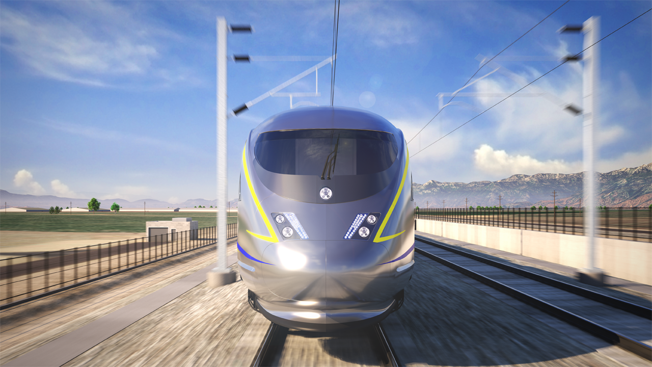
The California High-Speed Rail Authority (CHSRA) on Feb. 25 released for Board approval a Final Environmental Impact Report/Environmental Impact Statement (EIR/EIS) for an approximately 90-mile extent of the 145-mile San Jose to Merced Project Section in Northern California.
The San Jose to Merced Project Section (see map below) would provide service from Scott Boulevard, just north of the San Jose Diridon Station, to a downtown Merced station. It comprises three separate portions: San Jose to Central Valley Wye, Central Valley Wye, and Ranch Road to Merced. The portion of the Project Section analyzed in this Final EIR/EIS is from Scott Boulevard, just north of San Jose Diridon Station in Santa Clara, to Carlucci Road in Merced County. This is referred to as the San Jose to Central Valley Wye Project Extent, which would extend 90 miles, passing through Santa Clara, San Benito and Merced counties and the cities of Santa Clara, San Jose, Morgan Hill, Gilroy and Los Banos.
The Final EIR/EIS evaluates four alternatives (see map below), and identifies Alternative 4 as preferred. That alignment, with a price tag of $19 billion, has the “lowest capital cost of the four project alternatives,” according to CHSRA. Alternative 4 would include upgrading existing rail lines between San Jose and Gilroy and constructing a new high-speed rail alignment with more than 15 miles of tunnels through Pacheco Pass in the Diablo Range. It also comprises 15.2 miles on viaduct, 30.3 miles at grade, 25.9 miles on embankment, and 2.3 miles in trench. The preferred alternative “will modernize and electrify the existing rail corridor from San Jose to Gilroy, allowing for both high-speed rail and electrified Caltrain service to South San Jose and Southern Santa Clara County,” according to CHSRA.
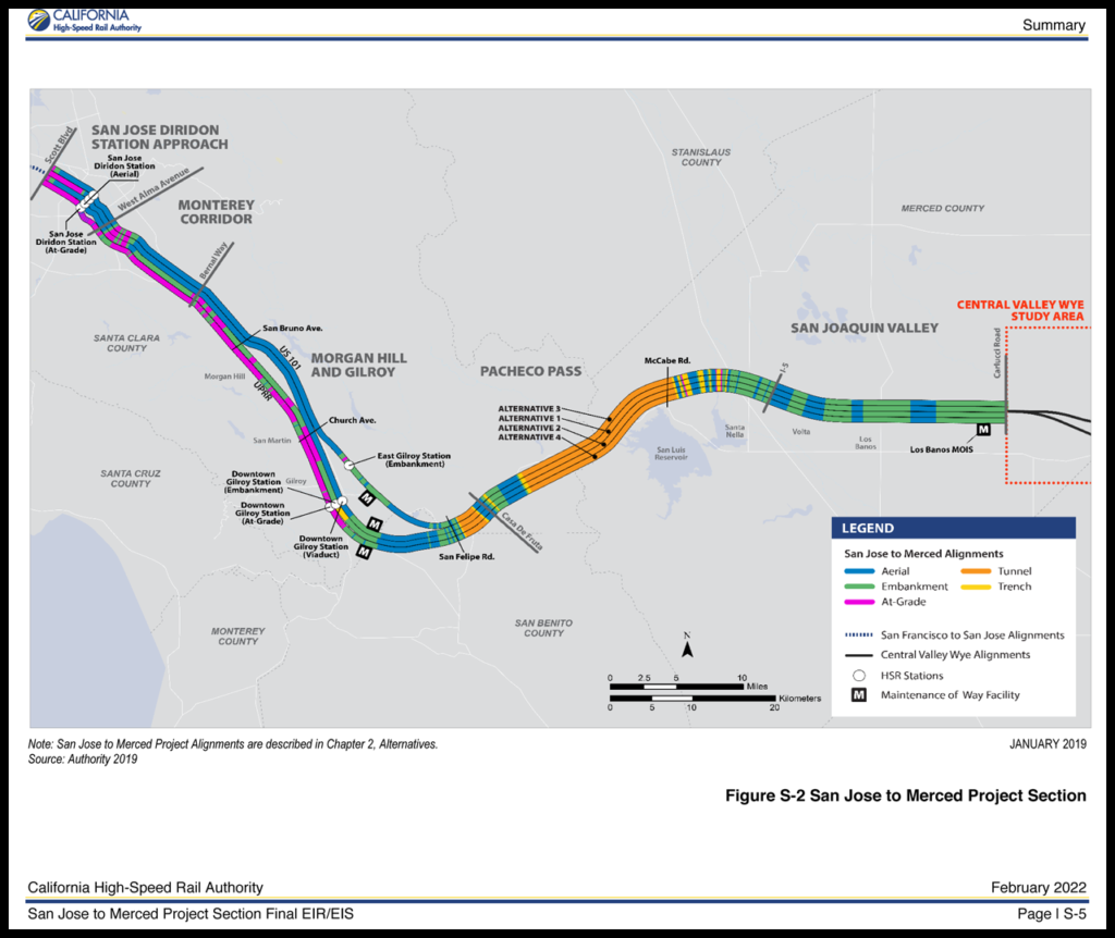
Alternative 4 also will “require the most longitudinal encroachments or acquisition of UPRR [Union Pacific] right-of-way,” CHSRA reported. “From Communications Hill (located in the Monterey Corridor Subsection) to the MOWF [Maintenance of Way Facility] south of Gilroy, HSR would install two electrified blended HSR tracks and one non-electrified freight track predominantly within existing UPRR right-of-way. The UPRR Hollister subdivision (located southeast of Gilroy) would be realigned to accommodate the MOWF and associated freight and HSR tracks. Within the UPRR right-of-way (south of Communications Hill) would be 99.8 miles of realignment.”
The CHSRA Board will consider the final EIR/EIS document for approval during its April 20-21 meeting, in conjunction with the proposed approval of the preferred alternative alignment. If green-lighted, “this project section will move closer to being ‘shovel ready’ for when pre-construction and construction funding becomes available,” CHSRA said.

“This environmental document is the culmination of years of analysis and stakeholder engagement and an important milestone in advancing high-speed rail between Silicon Valley and the Central Valley,” CHSRA CEO Brian Kelly said. “Connecting these two major economic regions will change the way people travel throughout the state and foster more equitable employment and housing opportunities. We remain committed to environmentally clearing all 500 miles [of the Phase 1 high speed rail alignment] from San Francisco to Los Angeles and Anaheim and advancing design statewide.”
In related developments, CHSRA on Jan. 20 certified the Burbank to Los Angeles Final EIR/EIS, approving the approximately 14-mile section of the Phase 1 rail alignment.