Mississauga looks to LRT
Written by John Thompson, Canadian Contributing EditorThe Hurontario Street LRT in Mississauga is expected to provide significantly improved transit for one of Ontario’s largest and fastest growing cities.
The City of Mississauga, Ontario, population 713,443 in 2011, is located immediately west of Toronto. Incorporated in 1974, it includes a number of former towns, such as Port Credit, Streetsville, Cooksville, Malton, etc., that have grown together over the years as development took over former farmland.
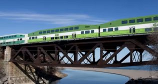
Public transit is furnished by Mississauga Transit, an all-bus system, three GO Transit regional/commuter rail lines, and various GO bus routes.
However, this picture will change in the near future, with the opening of the 12-mile Hurontario Street LRT line in 2022. Construction has been approved and is scheduled to commence in 2018.
Hurontario Street, also designated as provincial Highway 10, is Mississauga’s main north-south corridor. It extends northward to the adjacent city of Brampton and beyond, ultimately terminating at the Georgian Bay city of Owen Sound. In Mississauga, Hurontario Street is chiefly a minimum of six lanes wide, and much of it is characterized by high-density residential and commercial development along its length.
The LRT will extend from Port Credit GO Station, just north of Lake Ontario, to Gateway Terminal, at a shopping mall at Steeles Avenue West, just inside Brampton. It was originally planned to continue up Hurontario, into downtown Brampton, several miles northward, but this extension was rejected by that city’s Council in 2015.
 A short loop, as shown on the accompanying map, diverts the LRT into Square One/Mississauga City Centre, which, in addition to Ontario’s largest shopping mall, includes the city’s municipal offices and office and residential towers. A major bus terminal for Mississauga Transit and GO Transit is also located here. It may be expected that certain trains will serve the Square One complex, while others will continue along the main line.
The LRT will connect with two GO Transit rail lines: on the Lakeshore West Line at Port Credit (the former CN Toronto-Hamilton line); and on the Milton Line at Cooksville, situated on CP’s Toronto-Windsor route. It also crosses four major highways, including the Toronto-Buffalo QEW (Queen Elizabeth Way), and Montreal-Toronto-Windsor Highway 401. Several important east-west thoroughfares are also crossed.
The alignment is to be entirely surface-running, in a center reservation, with 22 stations. High-traffic stations, in addition to the GO train facilities, are forecast as Gateway, Rathburn and Main (at Burnhamthorpe Road, Square One).
The main line running time is forecast to be approximately 40 minutes. The LRT is expected to attract some 22,500 a.m. boardings by 2031, or 31.9 million annually.
The Province of Ontario is funding 100% of the capital cost, through Metrolinx, the provincial transit agency. The actual form of project delivery has yet to be decided. Consideration will be given to the Alternative Financing and Procurement (AFP) method.
The LRV model, design and builder has not been selected at this time. However, the LRV will be a low-floor articulated car approximately 90 feet long. Operation is initially be in two-unit consists; provision is being made for three-car trains in the future. Each LRV is to have a capacity of approximately 200 passengers.
The Maintenance and Storage Facility (MSF) is being designed to accommodate 44 LRVs for the launch of service. The facility’s design will accommodate an ultimate 74 LRVs, with expansion.
The preferred site for the MSF is on a parcel of provincially owned land bounded by Highway 407 to the north, Hurontario Street to the west, a power line corridor to the south and Kennedy Road on the east. This facility’s location will be near the LRT’s northern terminal.
